Monday, 16 September 2013
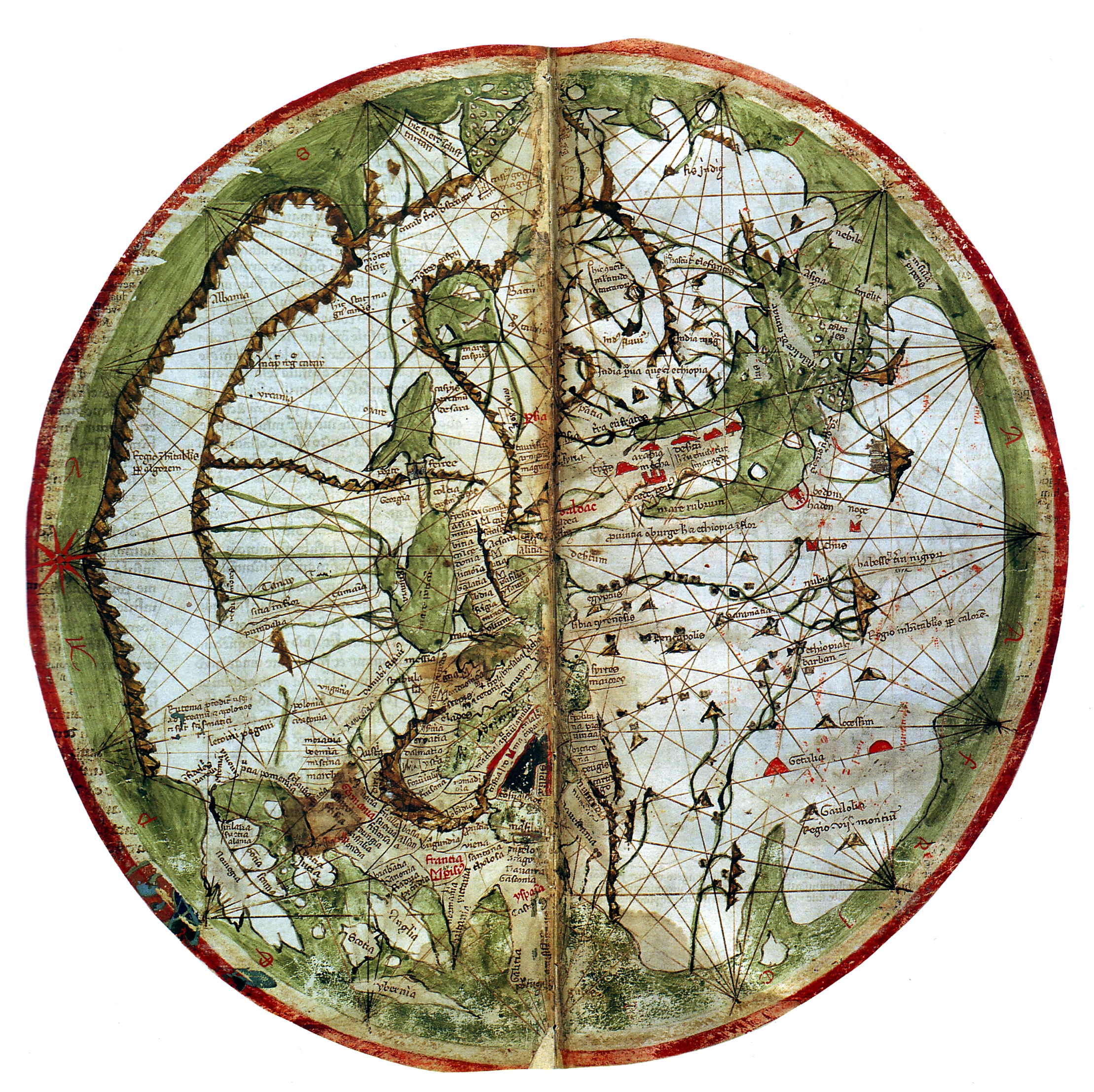
A few weeks ago we trailed that we had some exciting news and now we can finally announce it. Thanks to the generosity of The Andrew W. Mellon Foundation, Pelagios is entering a third, even more ambitious phase. We will be extending the Pelagios approach to all early geospatial documents up to 1492 (a game-changing year for the history of cartography). This means that we'll be dealing with texts and maps, not only from the ancient Greco-Roman worlds, but also the early Byzantine, Christian, Maritime, Islamic and Chinese traditions.
With a digital place index of maps and descriptions of the world in place, researchers and the general public will be able to explore online the historical significance of both famous and obscure places in the history of geography. As just one example, Claudius Ptolemy used London as one of his primary reference points for global time zones in the late second century, just as we do today. While such coincidences may be rare, and many places in early maps and texts are unidentified, or existed only in the popular or religious imaginations, our aim is to help their rich biographies to be told. With such an unprecedented variety of data linked together, it will be possible to trace in broad terms the continuities - and discontinuities - of people's responses to the world around them. Equally exciting, and thanks to the continuing annotation of data by Pelagios growing community of partners, you'll also be able to bring together disparate fragments of its life history, its connections with other places, its stories and imagery.
The project raises significant technological challenges as well. First of all we will need to make sure that URI-based gazetteers (standardised lists of places) are available for all of our periods and regions, and aligned with one another so that they can be cross-referenced. This means working not only with our old friends at Pleiades, but also with new ones at the China Historical GIS and PastPlace. Then we will need to use a raft of methods, old and new, to identify toponyms in texts and images, and in a range of languages. Optical Character Recognition (OCR) – a computer-based method for the automatic recognition of text in digitized images – is inadequate for use with medieval handwritten script. Therefore we are developing new, semi-automatic methods, which employ image processing and statistical approaches to eliminate as much of the tedious manual work of transcription as possible. Third, we will need to relate those place references to the gazetteers, building on the knowledge and expertise of a network of experts, along with a few tricks of our own. Places that we can't identify we intend to throw out to the public, along with any clues we have available, to invite the wider community to have a go. Finally, we continue to work on the Pelagios search API and web interface so that the results will become ever easier to work with and incorporate in other digital resources online.In addition to the continually growing community of projects providing content about all these places, we will be working in collaboration with specialists from all around the world, including from the British Library, Queen Mary, University of London, KCL, the University of Portsmouth, the University of Edinburgh, the Orient Institute of Beirut, the Institute for the Study of the Ancient World, Drew University and Harvard University. If you would like to get involved in any way, please do contact us!
And see AWOL's Roundup of Resources on Ancient Geography


 Stumble It!


No comments:
Post a Comment